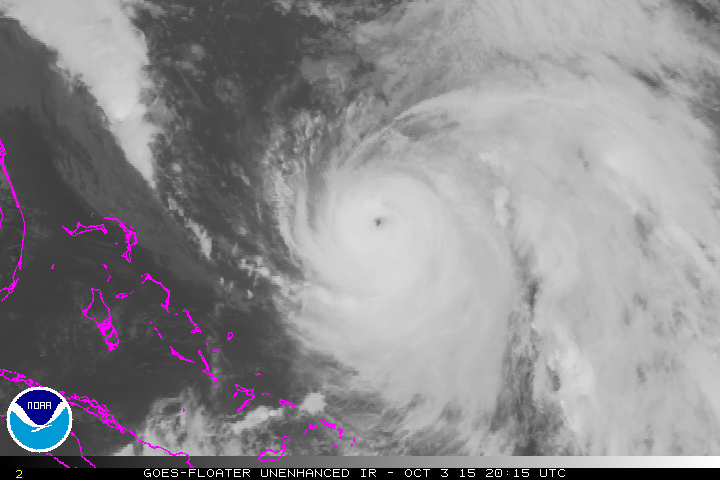
As much as 12 to 15 inches of rain is expected through Sunday for portions of South Carolina. A stagnant weather pattern with a stationary front and upper low over the Southeast combined with a moisture plume from Joaquin to produce this extreme rainfall. Joaquin is now a Category 4 storm with 125 winds. It will move out to sea as an upper low over the Southeast pushes the storm away. The very strong high over eastern Canada combined with low pressure over the Southeast, produced a persistent onshore flow that produced rough seas and serious coastal flooding from New Jersey, Long Island and southward along the East Coast. The winds will begin to decrease on Sunday in NJ and in the Southeast early next week. An active weather pattern will be present of the lower 48 states over the next two weeks.
George Wright is a Certified Consulting Meteorologist for Wright Weather Consulting, LLC. Visit our website at WrightWeather.com. Follow George Wright on Twitter @gwweather.


Seaside Heights from the Weather Channel: