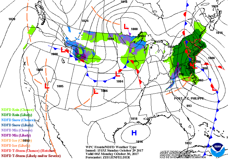
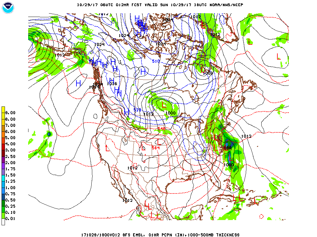
On the 5th year anniversary of Hurricane Sandy, the New York City metropolitan area and New England will experience a strong Nor'easter as a strong upper jet stream trough forms a storm along the Mid-Atlantic coast today that will combine with Tropical Storm Phillipe as it races up the coast. Phillipe now has 50 mph winds and is moving northeastward away from the Florida coast at 31 mph. Radar indicates a large area of heavy rain from the Mid-Atlantic states to New England. More than 4 inches of rain is expected for New York City. A High Wind Warning is in effect for gusts to 75 mph across Suffolk County, Long Island, Southeast Connecticut and coastal New England. A Wind Advisory is in effect for the entire New York City metropolitan area into New England for gusts to 50 mph tonight and Monday. Sunshine returns on Monday with temperatures continuing to be above normal for the Northeast through next weekend. The cold air that has been in parts of the Midwest has not been able to move into the Northeast so far this month. However, the GFS model is forecasting our first taste of winter for the New York city area around November 8th or 9th.
George Wright is a Certified Consulting Meteorologist for Wright Weather Consulting, LLC. Visit our website at WrightWeather.com. Follow George Wright on Twitter @gwweather.