Search This Blog

Saturday, July 11, 2020

Tropical Storm Fay Moved Through New Jersey on Friday...Gusts Over 50 mph, 1 to 3 Inches of Rain

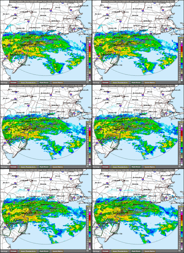
Tropical storm Fay moved through New Jersey on Friday dumping up to 3 inches of rain with a peak gust of 52 mph at St. George in Staten Island. The storm formed near the Gulf Stream off the coast of North Carolina. Instead of moving northeast like a lot of these storms do, an area of high pressure blocked the storm and kept it on a northerly track.  The storm was located in Central New Jersey early Friday evening.  The storm then dissipated as it moved into upstate New York.  Rainfall totals included:

New Jersey:

Teterboro Airport 2.62 in.   
Oakland 2.31 in.   
Tenafly 1.73 in.
West Orange 2.88 in.
Caldwell 2.75 in.
Weehawken 2.91 in.
Little Falls 2.96 in.
Newark Airport 2.68 in.
Perth Amboy 1.84 in.

New York:

Harlem 2.56 in.
Hewlett 1.84 in.
New York 3.11 in.
Midtown Manhattan 2.96 in.
Central Park 2.43 in.
NYC/JFK Airport 2.31 in.
NYC/La Guardia 2.20 in.
Staten Island 2.48 in.

There is a chance of showers and thunderstorms today and tomorrow, but sunny, hot weather will return next week. Some of the graphics below came from the tropicaltidbits.com website. 

George Wright is a Certified Consulting Meteorologist for Wright Weather Consulting, LLC. Visit our website at WrightWeather.com. Follow George Wright on Twitter @gwweather.