skip to main |
skip to sidebar
There was a wide variation in snowfall across the New York City metro area. The heaviest snow fell across Connecticut. Here are some snow totals from today in the New York City metro area. The maps below indicate that the storm is moving away and another rain making storm is coming in on Monday with 50 degree temperatures. No snow in sight for the next week or more.
Connecticut:
SHELTON 9.5"
GREENWICH 8.0"
BRIDGEPORT 6.2"
HADDAM 11.0"
NORTH HAVEN 12.0"
SALEM 10.5"
New Jersey:
OAKLAND 6.5"
CEDAR GROVE 3.8"
WEST ORANGE 3.5"
NEWARK AIRPORT 3.3"
SECAUCUS 4.5"
RINGWOOD 8.0"
New York:
BRONX 4.2"
SHEEPSHEAD BAY 2.1"
CENTRAL PARK 4.3"
UPPER WEST SIDE 4.2"
MONROE 5.1"
CARMEL 6.0"
ASTORIA 3.5"
LAGUARDIA AIRPORT 3.4"
TALLMAN 7.0"
UPTON 5.5"
ISLIP 3.0"
HASTINGS-ON-HUDSON 4.5"
WHITE PLAINS 4.2"
George Wright is a Certified Consulting Meteorologist for Wright Weather Consulting, LLC. George is also a meteorologist with ABC News and Cablevision News 12. Our website is WrightWeather.com.
A cold front has generated a dusting in the suburbs tonight here in the NYC metro area. A few flurries fell in Manhattan with no accumulation. Sunshine will give way to increasing clouds on Friday with light snow after midnight and during the morning on Saturday. Models are forecasting 2 to 4 with perhaps 5 inches for the city but there is practically no upper-level support at 500 mb so the snow will be produced by overrunning of warm, moist air from the south over weak high pressure over New England. Typically this situation only produces 1 to 3 inches and since temperatures are forecast to rise above freezing, expect the accumulations to be on the lower range. But since this is the first snowfall since October 29, 2011 here in the city, it will be a noteworthy event.
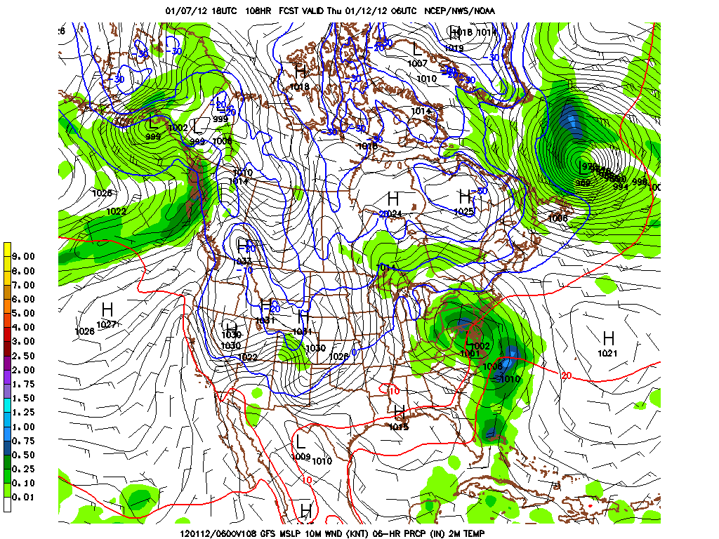
The GFS indicates an active pattern over the next 16 days with mostly rain here in the NY metro region. The storm track continues to be very far west with low pressure tracking into the St. Lawrence River Valley. The NAO is still positive which forecasts little cold and snow for the Northeast. There was more than 6" of snow in the Seattle area during the last 48 hours. Alaska has seen record snowfalls with more than 15 feet so far in Cardova and Anchorage.
George Wright is a Certified Consulting Meteorologist for Wright Weather Consulting, LLC. George is also a meteorologist with ABC News and Cablevision News 12. Our website is WrightWeather.com.
The temperature today reached a record high of 64 in Newark, NJ and it was 62 in Central Park. The trend is for a western storm track that produces rain across much of the Northeast. The cold air outbreaks are lasting only a few days since the pattern is very progressive with little blocking the jetstream especially in the north Atlantic. There could be some snow around January 18, 2012 in parts of the Northeast according to this GFS model run.
George Wright is a Certified Consulting Meteorologist for Wright Weather Consulting, LLC. George is also a meteorologist with ABC News and Cablevision News 12. Our website is WrightWeather.com.