skip to main |
skip to sidebar
Heavy Snow Possible with a Nor'easter this Friday and Saturday in New York and New England...
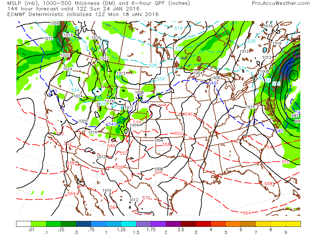
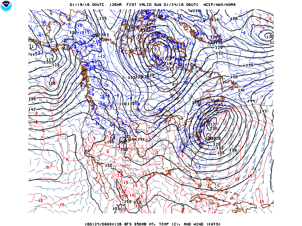
The GFS model currently is forecasting a storm developing over the Mississippi River Valley on Thursday tracking northeast off the coast of Long Island by Sunday morning. The model has been quite consistent with this forecast and is similar to the European model. The forecast can change especially since the energy that will generate this storm is still located in the eastern Pacific at 500 mb. Right now the potential exists for a foot or more of snow in parts of the NYC metro area and New England. There is always the possibility of a change to rain and sleet especially over the coast and eastern Long Island that could reduce the amount of snow. In addition, the track of the storm could also change so that it moves too far south to produce heavy snow. The NAO and AO are post negative, the AO is strongly negative and the PNA is positive. These indices indicate typically indicate snow and cold for the Northeast. The pattern over the next two weeks appears to be quite active in response to the strong southern jetstream produced by El Nino. I will have more updates later this week.
George Wright is a Certified Consulting Meteorologist for Wright Weather Consulting, LLC. Visit our website at WrightWeather.com. Follow George Wright on Twitter @gwweather.