Hurricane Ida came ashore yesterday afternoon as the 2nd strongest hurricane on record to hit Louisiana. Catastrophic storm surge, torrential rain and winds gusting to over 170 mph created extensive damage and flooding.
The Weather Channel reported:
Hurricane Ida's catastrophic crawl across Louisiana inundated miles of roadways and neighborhoods, ripped apart buildings and trapped hundreds of residents who can't call 911 because service has been knocked out, and cannot be rescued because conditions are still too treacherous to reach them. At least one levee overtopped in lower Jefferson Parish, sending more than 7.5 feet of floodwaters surging into Jean Lafitte, Barataria and Lafitte. Residents there had to flee into their attics to escape the rising water. "Total devastation. It's catastrophic. Our town levees have been overtopped. I have never seen so much water in my life. It's turned into a total rescue mission. People's lives are at stake now," Jean Lafitte Mayor Tim Kerner told WGNO. More than 1 million customers in Louisiana alone were without power, including all of New Orleans, where catastrophic damage occurred to the city's transformers.
PRELIMINARY LOCAL STORM REPORT
NATIONAL WEATHER SERVICE NEW ORLEANS LA
956 PM CDT SUN AUG 29 2021

..TIME...   ...EVENT...      ...CITY LOCATION...     ...LAT.LON...
..DATE...   ....MAG....      ..COUNTY LOCATION..ST.. ...SOURCE....
            ..REMARKS..

1250 PM     HURRICANE        PORT FOURCHON           29.11N 90.20W
08/29/2021                   LAFOURCHE          LA   SHIP

            SEACOR EAGLE INSTRUMENT RECORDED A SUSTAINED
            WIND OF 149 MPH WITH A GUST OF 172 MPH. THIS
            OCCURRED AS HURRICANE IDA MADE LANDFALL.
1045 AM STORM SURGE 1 W GALLIANO 29.43N 90.32W 08/29/2021 LAFOURCHE LA STORM CHASER MULTIPLE HOUSES REMOVED FROM THEIR FOUNDATION BY STORM SURGE.1219 PM STORM SURGE 2 NNE YSCLOSKEY 29.87N 89.67W 08/29/2021 ST. BERNARD LA C-MAN STATION SHELL BEACH (SHBL1) ALREADY RECORDING A SURGE OF AROUND 7.2 FEET (6.6 MHHW).
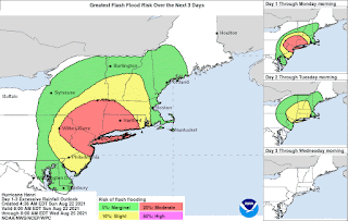
Ida will continue to produce flooding rain and wind gusts over 60 mph today. The storm will then track to the Northeast passing off the New Jersey coast on Thursday. Heavy rain is forecast for the New York metro area Wednesday.


