skip to main |
skip to sidebar
The temperature in Central Park at noon with snow is 33, it is 33 in White Plains and 34 at JFK. Snow is also falling in NJ, 33 in Caldwell and it is 34 in Teterboro. Snow is falling this afternoon across the NYC metro area, a large portion of PA, northern NJ and southern New England. Over a foot of snow is expected across parts of the Catskills in NY. The last time measurable snow fell in Central Park before Halloween was back in 1925 when 0.8-inch fell. Only three times since weather records began in Central Park back in 1869 has measurable snow been measured in October. A Winter Weather Advisory is in effect for New York City, 2 to 4 inches of snow expected and a Wind Advisory is in effect for 55 mph gusts. A huge area of snow, sleet and freezing rain covers the Northeast. Moderate to heavy snow is now falling in Midtown. A foot or more of snow is forecast in upstate New York near Peekskill with as much as 8 inches in Westchester and Rockland Counties.
George Wright is a Certified Consulting Meteorologist for Wright Weather Consulting, LLC. George is also a meteorologist with ABC News and Cablevision News 12. Our website is WrightWeather.com.
A winter storm will produce up to a foot of snow in upstate New York and interior Connecticut this weekend. It looks like a white Halloween for a good portion of the New York metro area especially in the northern and western suburbs. A Winter Storm Warning is in effect for interior northern NJ, interior NY and CT. A Winter Weather Advisory is posted for all of New York City, northeastern NJ and coastal CT. The snow will begin early tomorrow morning and mix with or change to rain along the coast and in the city then change back to mainly snow Saturday night. Sunday and Halloween will be sunny.
George Wright is a Certified Consulting Meteorologist for Wright Weather Consulting, LLC. George is also a meteorologist with ABC News and Cablevision News 12. Our website is WrightWeather.com.
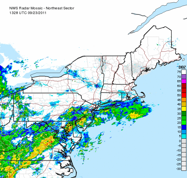
The models continue to indicate the presence of a strong ridge over the western Atlantic and a strong, almost stationary upper-level cyclone over the Ohio Valley. This cyclone or vortex gradually weakens and pushes to the northeast into eastern Canada where is it absorbed into the mean jetstream flow. The satellite and first radar image below were from 9:30 a.m. yesterday. The last radar image below is the current radar that still indicates more showers and thunderstorms across the NYC metro area and to the south.
Rainfall totals for the past 24 hours:
Central Park 2.61"
White Plains 2.57"
West Milford, NJ 2.55"
Newark, NJ 1.39"
JFK Airport 1.07"
George Wright is a Certified Consulting Meteorologist for Wright Weather Consulting, LLC. George is also a meteorologist with ABC News and Cablevision News 12. Our website is WrightWeather.com.