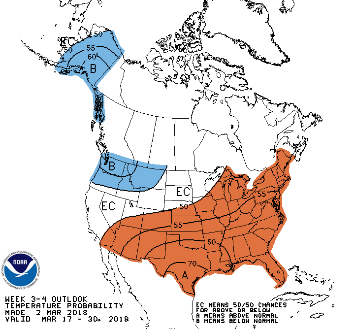
The GFS model had been amazingly consistent over the past two weeks with the development of this new coastal storm. Low pressure is weakening over the Ohio Valley this evening. Another low is developing over South Carolina. This storm will strengthen as it moves northeastward along the coast to a position south of Long Island Wednesday evening. Already a large area of snow and rain has spread northward from South Carolina to New York State. Winter Storm Warnings are in effect from Pennsylvania to Maine for 4 to 8 inches in the city and as much as 12 to 18 inches with isolated higher amounts over the northern and western suburbs. This will be the second Nor'easter in six days following the major storm that impacted the Northeast last Friday and Saturday. Dry and unseasonably cold weather will continue for the rest of the week. There is the possibility of another coastal storm that could impact the Mid-Atlantic early next week. The North Atlantic Oscillation (NAO) and the Arctic Oscillation (AO) which had been pretty much positive since the major cold spell of late December and early January ended, has trended sharply negative. These indices are forecast to remain negative over the next week or so which will allow for cold air to funnel down from Canada to end the winter season.
George Wright is a Certified Consulting Meteorologist for Wright Weather Consulting, LLC. Visit our website at WrightWeather.com. Follow George Wright on Twitter @gwweather.