skip to main |
skip to sidebar
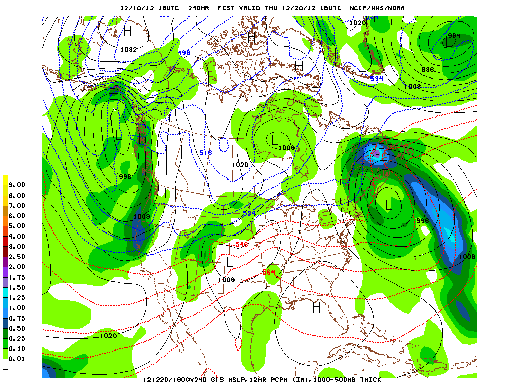
East Coast Storm Next Week?
The storm that brought blizzard conditions to the upper Midwest and over 10 inches of snow in parts of Minnesota is now tracking northeast across eastern Ontario. Rain associated with the storm's cold front will move across the eastern states tonight with sunshine returning on Tuesday. There were five reports of unconfirmed tornadoes today in Mississippi and Louisiana. The weather was cloudy with fog, drizzle and mild temperature readings in the low 60s in New York. The latest 18Z GFS model runs indicate that the weather will be colder for the next few days with a weak area of low pressure forming over the Southeast and moving off the coast and out to sea by Thursday, December 13, 2012. Another relatively weak area of low pressure is forecast to form by this upcoming weekend. The low then occludes as another storm forms to the southeast of the parent low. This storm is forecast to spread rain to the Mid-Atlantic states and coastal New England with some snow inland on Sunday and Monday, December 16-17, 2012. Then a strong vorticity maximum ejects southeastward from the Pacific Northwest and develops a much stronger low that originates in the Southeast and then intensities with strong upper level support at 500 mb into a coast Nor'easter that could bring snow to the New York City metropolitan area on Wednesday, December 19, 2012. Another coastal storm is forecast to form on or just before Christmas Day. The European Model is also forecasting the storm on or about December 19,2012 but is keeping the storm inland with an all rain even for New York City and southern New England. This system will need to be watched in subsequent model runs. From these models we are able to gather information regarding the overall trend with the actual day to day weather less important especially after 7 days. However, it is interesting to compare earlier runs to see how the models performed. From the 18Z run to the 12Z GFS run, next week's storm tracks appear to be moving farther south with high pressure in place to the north. The flow at 500 mb is more energetic with several shortwave troughs diving into the lower 48 states from the west. More updates to follow on next week's potential storm.
George Wright is a Certified Consulting Meteorologist for Wright Weather Consulting, LLC. George is also a meteorologist with ABC News and Cablevision News 12. Our website is WrightWeather.com. Follow George on Twitter @gwweather.