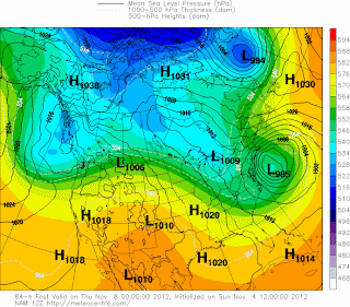
A review of the European, UKMET, CMC, GES, NAM, NOGAPS, MRF and GFS models indicates that a coastal storm will pass to the east of New York City and New Jersey on Wednesday afternoon into Thursday morning. The NAM is taking the storm farthest to the east as the other models bring the storm closer to Long Island. A relatively strong high to the north will produce an enhanced pressure gradient that will result in winds to 40 to 50 mph as the storm tracks to the east. One to 2 inches of rain could fall with this system. At 500 mb, jet stream energy produces a short wave trough that dives across the Midwest in 24 hours. This energy then develops an area of surface low pressure near the Southeast coast. As the storm develops, the upper trough develops into a cutoff low centered near New York City. The GFS model is forecasting a 984 mb low about 100 miles to the southeast of Atlantic City at 1 AM Thursday morning. More updates to follow this week.
George Wright is a Certified Consulting Meteorologist for Wright Weather Consulting, LLC. George is also a meteorologist with ABC News and Cablevision News 12. Our website is WrightWeather.com.


