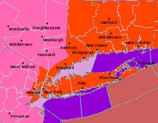
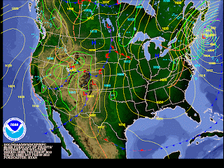
The National Weather Service has issued Blizzard Warnings for New York City, Long Island, northeast New Jersey, Connecticut, Rhode Island, eastern Massachusetts and the southeast coast of Maine from Friday morning through Saturday morning. All computer models are forecasting a rapidly intesifying storm about 100 to 150 miles southeast of New York City by late Friday afternoon. The storm is forecast to be near Cape Cod by Saturday around 1 PM. The worst of the storm for the New York metropolitan area will be from about 6 PM Friday through about 5 AM Saturday. Blowing and drifting snow will reduce visibilites to near zero at times and winds will gust to as high as 65 mph. Moderate coastal flooding, beach erosion and storm surges up to 5 ft. are expected along the coast. Flood Warnings are issued in flood prone areas. Waves up to 7 or 8 ft. in height are forecast along the ocean. Boston, most of Connecticut, Cape Cod, Rhode Island and coastal Maine are expecting 18 to 24 inches of snow. Accumulations of 10 to 15 inches are forecast for New York City and across Long Island with 5 to 10 inches expected from central New Jersey into northwestern New Jersey.
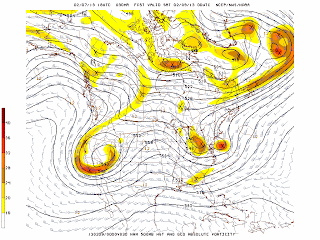
Models are forecasting a minimum pressure for this storm to be about 975 mb or 28.79 inches. The storm will be at its strongest when it is close to Cape Cod Saturday morning. The cold northern branch of the jet stream and the moist warmer southern branch are combining close to or just off the coast in the New York metro area around 7 PM Friday that will leading to strong vertical velocities and snowfall rates of 1 to 3 inches per hour that will quickly accumulate. We have only had 8.8 inches of snow so far in Central Park this winter but in one storm we could be above the normal seasonal snowfall of 25.1 inches. There could be as much as 3 feet of snow along the coast of Rhode Island and Massachusetts in areas when heavy snowfall banding sets up.
The main problems associated with this powerful storm will be impassable roads, zero visibility at times, damaging winds that will knock down trees and power lines, heavy snow that will be difficult to shovel, power outages due to breaking of limbs and trees onto power lines, moderate coastal flooding, snow covered roads through most of Saturday and very cold temperatures and wind chills Saturday night with lows in the single digits and teens but wind chills below zero.
George Wright is a Certified Consulting Meteorologist for Wright Weather Consulting, LLC. George is also a meteorologist with ABC News and Cablevision News 12. Our website is WrightWeather.com. Follow George on Twitter @gwweather.


