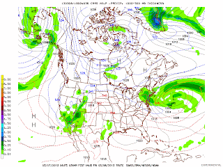
A Norlun trough extending from a strong storm that is located about 350 miles east of New York City has spread a large and extensive area of snow across New England tonight. In addition, a strong shortwave at 500 mb is moving eastward and intensifying the snowfall. As much as 7 inches of snow has already fallen in Taunton, MA this evening. Winter Storm Warnings and Winter Weather Advisories are in effect from eastern MA southward to New York City through Friday morning. After a relatively precipitation-free but windy day on Thursday, Boston and New York will see snow tonight. Up to 12" of snow is forecast for Boston and Worcester, MA with up to 5" to 6" inches in the New York City metropolitan area. The precipitation will end Friday afternoon in New York and Friday evening in Boston. The weather will be sunny and milder this weekend.
George Wright is a Certified Consulting Meteorologist for Wright Weather Consulting, LLC. George is also a meteorologist with ABC News and Cablevision News 12. Our website is WrightWeather.com.


