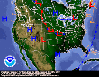
The fourth snow-producing storm in 10 days will affect the Northeast and the New York City metro area on Tuesday. A total of 1 to 3 inches of snow can be expected with some mixing in with rain expected along the coast of New Jersey and Long Island. A shot of cold air will follow the clipped and then milder air with ridging along the east coast will be in place by Friday with highs in the 40s to around 50 on Friday. A stationary front sets up in the east by Friday and into the weekend with periods of rain in the East at least for part of the weekend. The front moves south by December 23rd-24th and the rain may end as snow. High pressure is forecast by the GFS to build in on Christmas Day with sunny skies and seasonably cold weather in the Northeast. At the present time, the weather looks dry on Christmas across most of the nation except for a clipper system producing snow across the northern plains and the Great Lakes. The GFS trend keeps the air relatively cold across the northern plains to the Northeast from Christmas Eve through New Years Day with the potential for clipper systems and a coastal storm. It is still very early and the forecast will likely change significantly. However, the trend is for cold, stormy weather to continue from the northern plains to the Mid-Atlantic and the Northeast.
George Wright is a Certified Consulting Meteorologist for Wright Weather Consulting, LLC. George is also a meteorologist with ABC News and Cablevision News 12. Our website is WrightWeather.com.


