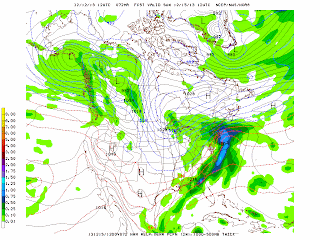
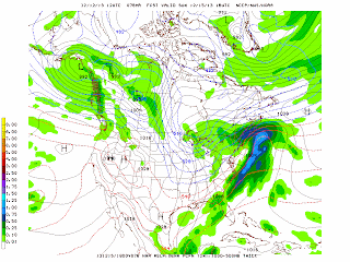
A coastal low pressure system that will spread snow from Virginia to New Jersey-New York City in the morning on Saturday. Up to a foot of snow is expected from upstate New York to extreme southern Maine. The snow should begin by noon in the city and become steadier during the afternoon with the heaviest snow expected in the late afternoon and early evening across southern/central New Jersey northward to New York City and Connecticut. The precipitation will be mostly a mix of snow and rain across Long Island since this low pressure system will be moving relatively close to the coast as it moves northeastward thereby bringing in warmer air farther inland. But even in Long Island and along the coast there will be accumulating snow before it changes to rain Saturday evening first across eastern Long Island and southern New Jersey and then in the city into the Lower Hudson Valley. Freezing rain and sleet will also mix in with the rain especially north and west of the city Saturday night. The precipitation will be mostly all rain by 1 AM Sunday morning across the New York City metro area. The precipitation ends as rain showers early Sunday morning with clearing and colder weather returning in the afternoon and into early next week. Two to 4 inches of snow in the city to up to 8 inches in the northern and western suburbs. Strong northwest winds across the Great Lakes have produced heavy snow for the past couple of days with more lake effect snow expected today and tomorrow.
George Wright is a Certified Consulting Meteorologist for Wright Weather Consulting, LLC. George is also a meteorologist with ABC News and Cablevision News 12. Our website is WrightWeather.com.


