Search This Blog

Saturday, February 28, 2015

Snow and Ice Sunday and Sunday Night for the New York City Metro Area...Winter Weather Advisories and Warnings from California to New England...

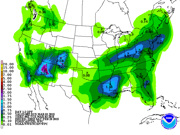
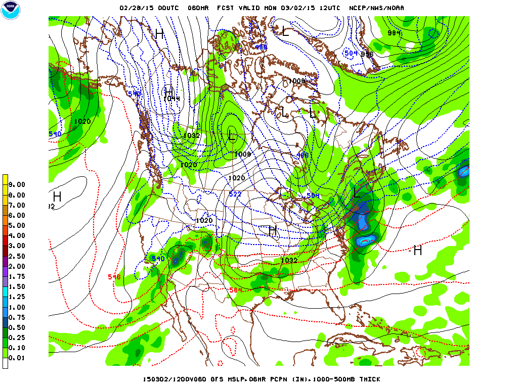
A broad southwest flow of moist air will be overrunning very cold air in the eastern US over the next two days. Winter weather advisories or warnings are in effect from California to New England. A Freezing Rain Advisory is in effect for northern South Carolina with very icy conditions tonight and Sunday. Highs on Sunday in northern South Carolina will only be in the upper 30s. A Winter Weather Advisory is in effect for New York City for 2 to 6 inches of snow.  This could be the last accumulating snow of the season for New York City.  This has been one of the coldest February's on record in New York with temperatures averaging more than 11 degrees below normal.  Snowfall has been about 8 inches above normal with 27 inches so far in Central Park.  Last year there was about 57 inches in the park.   
George Wright is a Certified Consulting Meteorologist for Wright Weather Consulting, LLC. Visit our website at WrightWeather.com. Follow George Wright on Twitter @gwweather.


Saturday, February 21, 2015

Snow, Sleet and Freezing Rain this Weekend from Missouri to Maine...

Low pressure over the southern plains this morning will move northeast to the Ohio Valley and the Great Lakes tonight.  A strong cold front will bring down more Arctic air to the Northeast Sunday afternoon and night.  Winter Storm Warnings and Winter Weather Advisories are in effect from Missouri to Maine.  Anywhere from 2 to 4 inches of snow and sleet is expected along the coast with up to 4 to 8 inches inland in the New York City Tri-State region.  The snow will mix with sleet and freezing rain tonight before changing to rain briefly along the coast Sunday morning.  The models have been trending colder for the past few days with the rain/snow line now as far south as central New Jersey and New York City.  This is about 25 or 50 miles farther south than the models were originally forecasting earlier this week.  This means more snow and ice across the New York metro area.  The 12 Z NAM keeps temperatures aloft at or below freezing with the exception of one layer warming slightly above freezing in 18 hours. The 540 DM thickness (approximate rain/snow line) increases to no higher than 541 for the La Guardia Airport.  This indicates the potential for freezing rain and sleet before perhaps a brief changeover to rain before the precipitation ends by mid-morning on Sunday.  The 850 MB freezing contour remains over or south of New York City and western Long Island for the entire event.  This indicates that if a changeover to rain occurs it will be brief or may not occur at all.  Any rain that falls could also freeze in contact with the colder ground.  The weather looks to be dry and cold for much of the upcoming week with a chance of snow showers Tuesday or Wednesday in the Northeast.  The GFS model is hinting at a coastal storm next Sunday for the Mid-Atlantic and the Northeast. 
George Wright is a Certified Consulting Meteorologist for Wright Weather Consulting, LLC. Visit our website at WrightWeather.com. Follow George Wright on Twitter @gwweather.