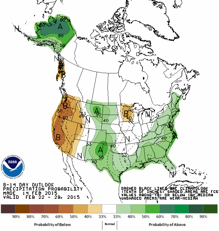
Blizzard Warnings continue for eastern Long Island, coastal CT and coastal New England for wind gusts to more than 60 mph. Up to 8 inches of snow is forecast for Boston with up to 2 feet for parts of Maine. The storm is strengthening tonight south of Long Island. The storm continues to produce snow across central and southern New Jersey. Light snow and blowing snow is occurring now in Perth Amboy, NJ where the temperature has fallen 9 degrees in the past couple of hours to 18 degrees. The roads are icy and snow covered especially on secondary roads. A Wind Chill Advisory is in effect for New York City and surrounding suburbs for wind chills as low of -20 F Sunday and Monday. This is the coldest air since January 2004 in New York City. A High Wind Warning is also in effect for gusts to more than 60 mph. There is a chance of snow on Tuesday but current models are keeping the snow south of New York City but the Mid-Atlantic could see some snow. There is another chance of snow next week. The weather looks much colder than normal in the Northeast with above normal precipitation for the next 6 to 14 days. Stay indoors or dress warm if you go outside since you can get frostbite in less than 10 or 20 minutes.
George Wright is a Certified Consulting Meteorologist for Wright Weather Consulting, LLC. Visit our website at WrightWeather.com. Follow George Wright on Twitter @gwweather.