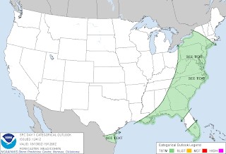
The rain that cancelled the Yankee-Tiger game last night is tracking eastward today. Showers and thunderstorms associated with a cold front will develop in the New York City tri-state area late tonight into Friday morning. The rain will fall heavily at times Friday with showers continuing into Saturday. The weather will be sunny and mild Sunday into early next week.
An interesting feature is the broad, cyclonic upper low that is forecast by the NAM model across southwestern Canada and the Pacific Northwest by 18Z on Saturday. This system will generate a broad area of rain with snow over Canada and the higher elevations of WA and ID this weekend. The NOAA Storm Prediction Center is not forecasting any areas of severe weather through the weekend at this time.
The long range trend is for relatively mild fall weather for the next 7 to 10 days across much of the nation. Around Halloween, the GFS model is indicating that a strong vortex with blocking over eastern Canada will pull down a strong shot of cold air that will be the first real winter-like blast of the season with possible light snow in parts of the upper Midwest, the Great Lakes and northern New England on about November 1st or 2nd.
Also, around November 1st, the GFS model is forecasting two tropical systems, one over southern FL and another one northeast of the Caribbean Islands. It will be interesting to see if this verifies.
George Wright is a Certified Consulting Meteorologist for Wright Weather Consulting, LLC. George is also a meteorologist with ABC News and Cablevision News 12. Our website is WrightWeather.com. Follow George Wright on Twitter.


