George Wright is a Certified Consulting Meteorologist for Wright Weather Consulting, LLC. George is also a meteorologist with ABC News and Cablevision News 12. Our website is WrightWeather.com.
Wednesday, October 10, 2012
Active Weather Pattern This Week in the US
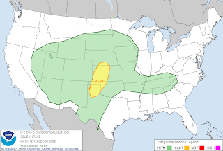
The GFS and NAM models are indicating that the weather will be relatively active across the nation during the next week. A cut-off low is circulating off the coast of southern California this morning with a vigorous long wave trough digging down across the Great Lakes. This trough has brought down chilly air into the upper Midwest and the Northeast this week. The cut-off low will begin to lift and track eastward spreading some snow at the higher elevations of the Sierra Nevada's and the southern Rockies with scattered areas of light rain across the southern plains by Friday. During Friday, the upper-low becomes a more vigorous shortwave trough that generates a surface low over northeastern Nebraska with up to 0.75 inches of 6-hour precipitation across the Great Lakes. At this time, the Northeast and Mid-Atlantic States are under the influence of a cool, dry 1030 MB high. A storm system moving into the Pacific Northwest on Friday will provide much needed rain to that region. This storm will produce appreciable rainfall through Monday. The shortwave trough and accompanying surface low over the Midwest lifts northeastward across the Great Lakes on Saturday and Sunday and into the St. Lawrence River Valley by Monday. This system could produce severe thunderstorms with heavy downpours along it's associated cold front in the Midwest and Ohio Valley on Saturday and Sunday.
George Wright is a Certified Consulting Meteorologist for Wright Weather Consulting, LLC. George is also a meteorologist with ABC News and Cablevision News 12. Our website is WrightWeather.com.
George Wright is a Certified Consulting Meteorologist for Wright Weather Consulting, LLC. George is also a meteorologist with ABC News and Cablevision News 12. Our website is WrightWeather.com.


