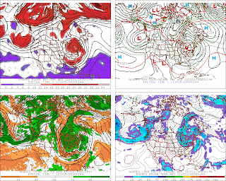
The numerical weather prediction models are now bringing Sandy closer to the Mid-Atlantic coast as it tracks northward. The models are now bringing the storm inland either near Delaware, New Jersey or Maine early Monday. Some models then rotate the storm across New England on Wednesday and out into the north Atlantic on Thursday. The official NHC storm track now takes the storm into New York City by Noon on Tuesday. The following is a summary of what each model was forecasting in their latest runs:
GFS - brings the storm westward from the western Atlantic into New England near Maine Tuesday night and then rotates it through New England and back northeastward into Nova Scotia on Thursday ***UPDATE: The latest GFS runs at 12 Z today now brings the storm very close to New York City and the Jersey Shore by noon on Tuesday. This model is now in line with ECWMF, NOGAPS and UKMET.**
CMC - similar track to the previous 6 Z GFS but brings the storm in earlier by Monday night and rotates it eastward across Pennsylvania and New Jersey on Tuesday night **UPDATE: This model now appears to be the outlier**
ECWMF - brings the storm across Delaware/New Jersey on Monday night and across Pennsylvania on Tuesday and then into the Great Lakes - similar track to UKMET and NOGAPS
NAVY NOGAPS - brings the storm near New Jersey/New York City on Sunday evening and inland across Pennsylvania on Tuesday - similar track to the ECWMF and UKMET
UKMET - brings the storm ashore near New York City on Tuesday and inland on Wednesday - similar track to ECWMF and NOGAPS
NAM - through 84 hours, the latest 8 AM run indicates that Sandy is moving closer to the east coast and is forecast to spread more than 6 inches of rain in a large area that includes among other areas, Delaware, New York City and New Jersey.
Therefore, it appears that the forecasts by the GFS, ECWMF, NOGAPS and the UKMET are now becoming more consistent. The model consensus may change but it appears that the models are now becoming in better agreement. The NAM continues to bring Sandy on a northward track that is closer to the coast. Right now it appears that flooding, high winds and power outages are a possibility in parts of the Northeast from Monday through Wednesday or Thursday. This storm has the potential to be a major storm with flooding, beach erosion, wind damage and coastal flooding. It is unusual since it is very late in the hurricane season, as Sandy tracks northward it is forecast to become entrained or captured by an advancing trough that will greatly intensify it and the storm is forecast to move from east to west (most storms move from west to east).
George Wright is a Certified Consulting Meteorologist for Wright Weather Consulting, LLC. George is also a meteorologist with ABC News and Cablevision News 12. Our website is WrightWeather.com.


