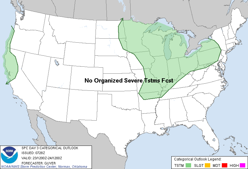
The weather will be mild across most of the eastern half of the country for the next few days. The high temperature will be near or above 70 degrees in New York City through Saturday. The high on Friday in the city is forecast to be 76 degrees. A cold front will produce showers and thunderstorms across parts of the Midwest and the Great Lakes states through Thursday. The NOAA SPC convective outlooks indicate that the threat of severe weather will be relatively low with scattered thunderstorms on Monday that may produce hail and strong wind gusts. Thunderstorms with some hail and strong winds are also possible on Tuesday from the Great Lakes, across parts of the Ohio Valley and into Texas. No organized severe thunderstorms are forecast on Wednesday.
Strong blocking conditions are evident at 500 mb by Thursday as a strong ridge will extend from eastern Canada southward to Florida providing "Indian Summer" weather to the Northeast. At this time a cut-off low is forecast over the Canadian maritimes with a broad trough in the northest US and western Canada. The rain will be coming to an end of the Pacific Northwest and the northern Rockies by Friday as an area of high pressure builds down from western Canada. A shot of cold air will plunge down from Canada into the western half of the nation with cool temperatures all the way down into Texas by Saturday and Sunday. On Saturday the GFS model is indicating a tropical system to the southeast of Florida that is forecast to remain offshore.
By Sunday, a broad longwave trough will dig southward across southern Canada and the Midwest. This trough is currently forecast by the GFS to form a significant coastal storm that will affect the New York City metro area as well as New England and the Mid-Atlantic States on Halloween. The storm is forecast to form along a frontal baroclinic boundary that will setup along the east coast as the tropical storm moves northeastward away from the coast. It is possible that some of the moisture from the tropical system will become entrained into the coastal low enhancing the rainfall. The storm is forecast to be near Cape Cod at 18 Z on Wednesday, October 31st. The storm is then forecast to retrograde in response to a deepening cut-off low that will take the coastal low into eastern Pennsylvania and then across New Jersey and out to sea by Thursday, November 1st. This forecasted storm is more than a week away so the forecast will likely change significantly. It will be interesting to see how accurate the forecast will be and how much in changes in future runs.
George Wright is a Certified Consulting Meteorologist for Wright Weather Consulting, LLC. George is also a meteorologist with ABC News and Cablevision News 12. Our website is WrightWeather.com. Follow George Wright on Twitter.