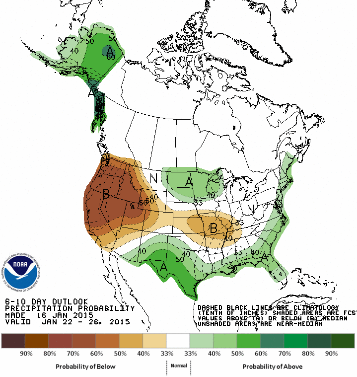
A low pressure system moving across the Great Lakes and Quebec will weaken as another low develops over the Mid-Atlantic. A 500 mb trough is now moving across the Midwest. As this trough moves east, it will develop a low that will produce a quick burst of heavy rain with more than 1 inch of rain forecast for the New York City metro area and coastal New England. Warm advection ahead of the low will result in little if any sleet or snow in the New York City metro area but on the back side of the storm Sunday evening there could be a changeover to snow before it ends with little accumulation. A Winter Storm Watch is in effect for parts of Vermont and New Hampshire including Burlington for 4 to 8 inches of heavy, wet snow. The storm will produce rain and wind gusts to 30 mph Sunday night during the Patriots playoff game. The storm is a fast mover and sunshine will return on Monday. A clipper system is forecast to produce light snow on Tuesday and Wednesday across the Ohio Valley and the Northeast. The GFS long range model is indicating a colder pattern for the Great Lakes to the Northeast and Mid-Atlantic for the next two weeks with the potential for a storm or two that could produce some snow along the coast. The 8-14 day outlook calls for below normal temperatures and above normal precipitation along the coast in the Northeast and Mid-Atlantic. A storm will produce more than 4 inches of rain in parts of the Pacific Northwest with flooding and wind gusts to 60 mph tonight and Sunday.
George Wright is a Certified Consulting Meteorologist for Wright Weather Consulting, LLC. Visit our website at WrightWeather.com. Follow George Wright on Twitter @gwweather.